


 was a British Army officer and frontiersman. Born in Methuen, Massachusetts, he fought in King George’s War, the French and Indian War and the American Revolutionary War. During the French and Indian War, Rogers raised and commanded Rogers’ Rangers, a ranger unit trained for carrying out asymmetric warfare.[2][3")


")


Fort Davis, Texas
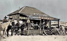
![]()
Fort Davis, Texas
From Wikipedia, the free encyclopedia
Jump to navigationJump to search
| Fort Davis, Texas | |
|---|---|
| Census-designated place | |
| Jeff Davis County Courthouse, located in Fort Davis | |
| Location of Fort Davis, Texas | |
Coordinates:  30°35′34″N 103°53′31″WCoordinates: 30°35′34″N 103°53′31″W 30°35′34″N 103°53′31″WCoordinates: 30°35′34″N 103°53′31″W | |
| Country | United States |
| State | Texas |
| County | Jeff Davis |
| Area | |
| • Total | 10.1 sq mi (26.1 km2) |
| • Land | 10.1 sq mi (26.1 km2) |
| • Water | 0.0 sq mi (0.0 km2) |
| Elevation | 4,892 ft (1,491 m) |
| Population (2010) | |
| • Total | 1,201 |
| • Density | 119/sq mi (46.0/km2) |
| Time zone | UTC-6 (Central (CST)) |
| • Summer (DST) | UTC-5 (CDT) |
| ZIP code | 79734 |
| Area code(s) | 432 |
| FIPS code | 48-26688[1] |
| GNIS feature ID | 1357584[2] |
Fort Davis is an unincorporated community and census-designated place (CDP) in Jeff Davis County, Texas, United States. The population was 1,201 at the 2010 census,[3] up from 1,050 at the 2000 census. It is the county seat of Jeff Davis County.[4]
Contents
History[edit]
It was the site of Fort Davis, established in 1854 on the San Antonio–El Paso Road through west Texas and named after Jefferson Davis, who was then the Secretary of War under President Franklin Pierce.[5] It was reestablished in 1867 following the civil war. [6][7]
Geography[edit]
Fort Davis is located in southeastern Jeff Davis County at the southeast foot of the Davis Mountains. Texas State Highway 17 (State Street) passes through the center of town, leading northeast 38 miles (61 km) to Interstate 10 at Balmorhea and southwest 21 miles (34 km) to Marfa. Texas State Highway 118 joins Highway 17 through the center of Fort Davis, but leads northwest through the Davis Mountains 52 miles (84 km) to I-10 and southeast 23 miles (37 km) to Alpine.
According to the United States Census Bureau, the CDP has a total area of 10.1 square miles (26.1 km2), all land.[3]
Fort Davis has the highest elevation above sea level of any county seat in Texas; the elevation is 4,900 feet (1,500 m).
Climate[edit]
Fort Davis experiences a semi-arid climate (Köppen BSk) with cool, dry winters and hot, wet summers. There is a large degree of diurnal temperature variation due to the high elevation of the area.
| hideClimate data for Fort Davis, Texas (Jan 1, 1902–Mar 31, 2013) | |||||||||||||
|---|---|---|---|---|---|---|---|---|---|---|---|---|---|
| Month | Jan | Feb | Mar | Apr | May | Jun | Jul | Aug | Sep | Oct | Nov | Dec | Year |
| Record high °F (°C) | 81 (27) | 85 (29) | 90 (32) | 97 (36) | 102 (39) | 107 (42) | 103 (39) | 101 (38) | 101 (38) | 100 (38) | 95 (35) | 79 (26) | 107 (42) |
| Average high °F (°C) | 60.8 (16.0) | 64.4 (18.0) | 71.3 (21.8) | 78.9 (26.1) | 85.8 (29.9) | 90.3 (32.4) | 88.4 (31.3) | 87.4 (30.8) | 83.2 (28.4) | 76.9 (24.9) | 67.5 (19.7) | 60.6 (15.9) | 76.3 (24.6) |
| Daily mean °F (°C) | 44.8 (7.1) | 48.1 (8.9) | 54.3 (12.4) | 62.0 (16.7) | 69.6 (20.9) | 75.3 (24.1) | 75.2 (24.0) | 74.2 (23.4) | 69.3 (20.7) | 61.3 (16.3) | 51.7 (10.9) | 45.2 (7.3) | 60.9 (16.1) |
| Average low °F (°C) | 28.8 (−1.8) | 31.8 (−0.1) | 37.3 (2.9) | 45.0 (7.2) | 53.4 (11.9) | 60.3 (15.7) | 62.1 (16.7) | 61.0 (16.1) | 55.3 (12.9) | 45.7 (7.6) | 35.9 (2.2) | 29.7 (−1.3) | 45.5 (7.5) |
| Record low °F (°C) | 0 (−18) | 0 (−18) | 10 (−12) | 20 (−7) | 26 (−3) | 40 (4) | 47 (8) | 46 (8) | 36 (2) | 18 (−8) | 8 (−13) | 0 (−18) | 0 (−18) |
| Average precipitation inches (mm) | 0.50 (13) | 0.46 (12) | 0.38 (9.7) | 0.54 (14) | 1.31 (33) | 1.98 (50) | 2.85 (72) | 2.91 (74) | 2.27 (58) | 1.35 (34) | 0.54 (14) | 0.55 (14) | 15.64 (397) |
| Average snowfall inches (cm) | 1.2 (3.0) | 0.7 (1.8) | 0.3 (0.76) | 0.1 (0.25) | 0.0 (0.0) | 0.0 (0.0) | 0.0 (0.0) | 0.0 (0.0) | 0.0 (0.0) | 0.2 (0.51) | 0.5 (1.3) | 1.0 (2.5) | 3.9 (9.9) |
| Average precipitation days (≥ 0.001 in) | 2.66 | 2.23 | 2.14 | 2.15 | 4.49 | 6.48 | 8.69 | 8.27 | 6.88 | 4.20 | 2.35 | 2.60 | 54.30 |
| Source: Western Regional Climate Center, Desert Research Institute[8] |
Demographics[edit]
2020 census[edit]
| Race | Number | Percentage |
|---|---|---|
| White (NH) | 547 | 53.42% |
| Native American or Alaska Native (NH) | 4 | 0.39% |
| Asian (NH) | 5 | 0.49% |
| Some Other Race (NH) | 6 | 0.59% |
| Mixed/Multi-Racial (NH) | 24 | 2.34% |
| Hispanic or Latino | 438 | 42.77% |
| Total | 1,024 |
As of the 2020 United States census, there were 1,024 people, 415 households, and 317 families residing in the CDP.
2000 census[edit]
As of the census[1] of 2000, 1,050 people, 415 households, and 298 families resided in the CDP. The population density was 188.2 people per square mile (72.7/km2). The 525 housing units averaged 94.1 per square mile (36.3/km2). The racial makeup of the CDP was 88.29% White, 0.19% African American, 0.48% Native American, 7.62% from other races, and 3.43% from two or more races. Hispanics or Latinos of any race were 49.33% of the population.
Of the 415 households, 32.0% had children under the age of 18 living with them, 57.6% were married couples living together, 10.6% had a female householder with no husband present, and 28.0% were not families. About 24.3% of all households were made up of individuals, and 9.9% had someone living alone who was 65 years of age or older. The average household size was 2.53 and the average family size was 3.02.
In the CDP, the population was spread out, with 24.7% under the age of 18, 7.4% from 18 to 24, 26.9% from 25 to 44, 25.4% from 45 to 64, and 15.6% who were 65 years of age or older. The median age was 39 years. For every 100 females, there were 102.3 males. For every 100 females age 18 and over, there were 97.3 males.
The median income for a household in the CDP was $25,882, and for a family was $27,955. Males had a median income of $22,500 versus $20,000 for females. The per capita income for the CDP was $14,249. About 20.7% of families and 21.6% of the population were below the poverty line, including 26.3% of those under age 18 and 26.0% of those age 65 or over.
Arts and culture[edit]
Points of interest[edit]
- Chihuahuan Desert Nature Center and Botanical Gardens at the Chihuahuan Desert Research Institute
- Fort Davis National Historic Site
- The McDonald Observatory of the University of Texas at Austin
- Fort Davis is home to one of 10 dishes comprising the Very Long Baseline Array
- Davis Mountains State Park
Education[edit]
Dirks-Anderson Elementary School
Fort Davis is served by the Fort Davis Independent School District.
- Dirks-Anderson Elementary School
- Fort Davis High School
Gallery[edit]
References[edit]
- ^ Jump up to:a b “U.S. Census website”. United States Census Bureau. Retrieved 2008-01-31.
- ^ “US Board on Geographic Names”. United States Geological Survey. 2007-10-25. Retrieved 2008-01-31.
- ^ Jump up to:a b “Geographic Identifiers: 2010 Census Summary File 1 (G001): Fort Davis CDP, Texas”. American Factfinder. U.S. Census Bureau. Archived from the original on February 13, 2020. Retrieved December 7, 2018.
- ^ “Find a County”. National Association of Counties. Archived from the original on 2011-05-31. Retrieved 2011-06-07.
- ^ “The Davis Mountains of Texas”, accessed September 13, 2010
- ^ “The First Fort Davis: 1854-1862”.
- ^ “CIVILIAN EMPLOYEES AT FORT DAVIS” (PDF).
- ^ “FORT DAVIS, TEXAS (413262), Period of Record Monthly Climate Summary”. Western Regional Climate Center, Desert Research Institute. Retrieved March 25, 2018.
- ^ “Explore Census Data”. data.census.gov. Retrieved 2022-03-05.
- ^ www.census.gov
- ^ “About the Hispanic Population and its Origin”. www.census.gov. Retrieved 18 May 2022.
- ^ Note: the US Census treats Hispanic/Latino as an ethnic category. This table excludes Latinos from the racial categories and assigns them to a separate category. Hispanics/Latinos can be of any race.[10][11]
External links[edit]
| Wikimedia Commons has media related to Fort Davis, Texas. |
| showvteMunicipalities and communities of Jeff Davis County, Texas, United States |
|---|
- Census-designated places in Jeff Davis County, Texas
- Census-designated places in Texas
- Jefferson Davis
- County seats in Texas
- Butterfield Overland Mail in Texas
- 1854 establishments in Texas
Navigation menu
- Not logged in
- Talk
- Contributions
- Create account
- Log in
Search
Contribute
Tools
- What links here
- Related changes
- Special pages
- Permanent link
- Page information
- Cite this page
- Wikidata item
Print/export
In other projects
Languages
